Last week I got the chance to deploy an ARGO float during the cruise. While the actual deployment is somewhat unclimactic, the chance to be a part of the larger project as a whole is quite exciting. What is an ARGO float you ask? Good question…
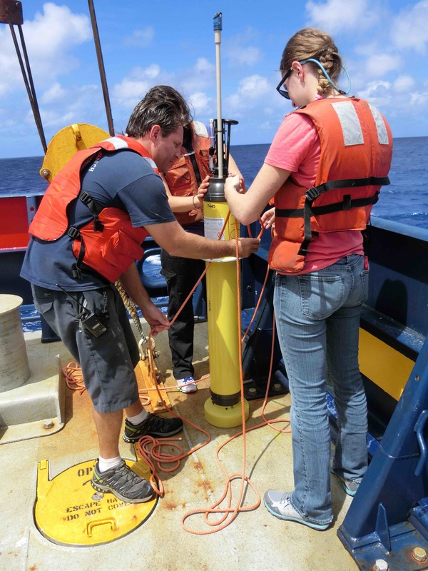 Matt, our restech, Molly, and I get the float ready to launch. | ARGO stands for Array of Real-time Geostrophic Oceanography. Beginning in the mid 2000s we (read: scientists) began releasing these free drifting “robots” into the ocean to remotely take measurements while we are sitting nice and cozy back in our labs. They work by moving with the natural currents of the ocean (no self-propulsion) but can control their buoyancy in order to move and up and down throughout the water column. These free drifters stay “parked” at a predetermined depth (normally around 1000m). Every 10 days or so, they descend to 2000 m and take a profile, measuring temperature and salinity, on its way back to the surface. These profiles, along with the surface GPS position, are then sent back to land via satellite. This is an international effort so various labs around the world are involve and help manage and process the data. These floats act to take a “pulse” of the ocean, giving us a glimpse into what is going on and helping us to diagnose larger problems that may arise. |
| Most of our floats spend 10 hours transmitting on the surface with one message transmitted every 60 to 72 seconds. This means that the floats transmit over 500 messages for each profile while waiting at the surface. Most of these transmissions are lost because no satellite happens to be overhead. “In fact, telemetry statistics show that only 7-10% of these messages are transmitted when a satellite is overhead” (PMEL ARGO information webpage). So that means that even when they are on the surface, they may not be able to communicate their data with the lab. As technology and science have improved, the floats have even more capabilities. In addition to temperature and salinity, many of the more recently released floats also include the ability to measure oxygen, pH, nitrate, and chlorophyll. These variables together can provide a direct link to the carbon system, something especially exciting to a biogeochemical oceanographer. I will be able to use this data in my analysis, and since they start working immediately upon deployment, the delay in getting data from the ocean to our computers is very short. You can never have too much data! | 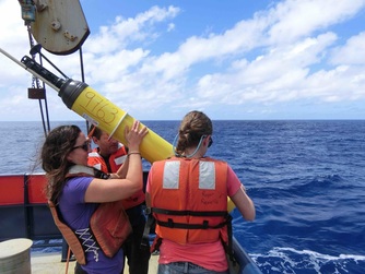 sending it overboard  There she goes...off to do her work. |
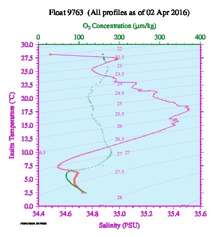 A depth profile of my float a day after deployment. Temperature on the y-axis and oxygen and salinity on the x-axis. Notice how complex the signals are in this part of the ocean. 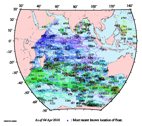 All the floats in the Indian Ocean as of April 4, 2016 | A current project focuses on putting these floats in the Southern Ocean, a specifically fierce region to take a ship, especially in the winter months. When deployed they travel with the (very fast) currents of the Southern Ocean and can even sense when ice is above them, waiting for months underwater before it clears and they are able to surface and transmit all of that data. Floats are expected to last 4 years, often traveling thousands of miles during their lifetime, consistently transmitting this valuable data to shore. On this cruise we will stop at just over 100 stations over a course of 38 days, costing millions of dollars (ship time, salaries, equipment shipping, food, etc). These floats are able to accomplish a similar task (but obviously much less thorough) for a much lower cost. Although they only go to 2000m (we go all the way to 6000m or whatever the deepest point is) and they can only measure certain variables (we measure many more variables from the water we capture in our Niskin bottles), they are a pretty great resource to have. The image on the left shows all the ARGO floats in the Indian Ocean right now, along with their tracks. The Indian Ocean is unique from other ocean basins in that it has the monsoons and also that it doesnt have a northern outlet for the water. The floats out there are giving us an amazing picture of how the circulation at different depths in the Indian Ocean work and how they change from season to season. Pretty exciting stuff! |
On the cruise I participated on last May I also had the chance to deploy an ARGO float. I went back and tracked how far it had gone since I released it in mid-June. It has since gotten sucked into the Alaskan gyre and is now moving quickly west towards the Bering Sea. I’m excited to see where it goes next.
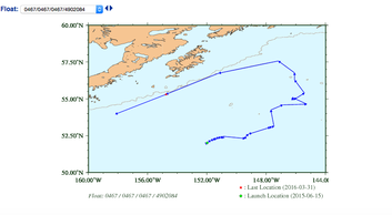 The track of my float released in June 2015 in the North Pacific. That is Alaska's coastline in the top of the image. | 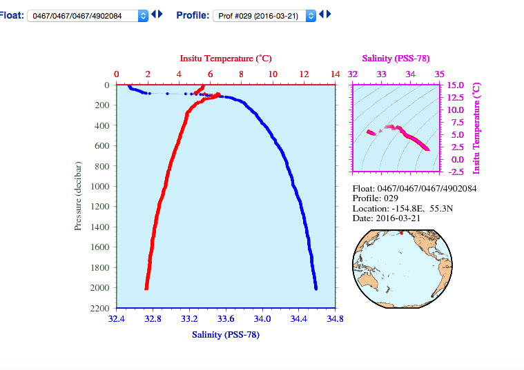 A profile of my float in the Alaska current. The low salinity values in the surface are common up near Alaska, from ice melt and the discharge of the large rivers in the region. |
As I type this, we are crossing over 5S and heading off of our previous straight-line trajectory up 95E and will begin to make a left turn as we head towards the equator. From here on out, our stations will be much closer together, meaning more work and less free time. We have experienced multiple lighting storms over the last couple days as well as consistent humidity above 80% and sporadic rainstorms. I have learned to recognize the sound of the winch when I wake up, alerting me to if we are on station or if we are transiting between stations (giving me an idea of what I’ll be doing when I start my shift). We have enjoyed some wonderful ethnic food on board, prepared by our talented cook. Last week I was excited to see sushi rolls and indian food leftovers in the fridge when I got down for breakfast. Our cup-cast is also coming up this week. For those of you who know what this means, any suggestions as to what I should put on my cup this time? And alas, while we have seen a couple ships on the horizon, still no wildlife!
 RSS Feed
